Showing 17–32 of 51 results
-
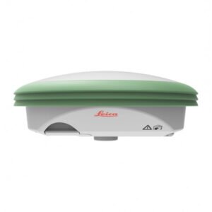
A lightweight antenna, even more compact. The smart antenna designed for you.
The Leica GS07 is a high-precision GNSS receiver for topographic and geodetic measurements in difficult terrain. With advanced satellite tracking technology, Bluetooth connectivity, and an intuitive user interface, the GS07 provides accurate and reliable measurements in challenging environments.
The GS07 is water and dust resistant, making it a robust and durable tool for field work. It is an ideal tool for professionals seeking precision and efficiency in their surveying work.
-
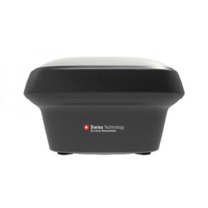
A GNSS smart antenna that grows with your business. Versatile premium-quality RTK surveying equipment.
The Leica GS18 is a high-precision GNSS (Global Navigation Satellite System) receiver designed for topographic field measurements. With its advanced satellite tracking technology, the GS18 provides accurate and reliable measurements even in challenging conditions.
Its ergonomic and lightweight design makes it easy to transport and handle during long workdays in the field. Additionally, its compatibility with the Leica Captivate software platform facilitates integration with other surveying instruments and data transfer for subsequent processing.
-
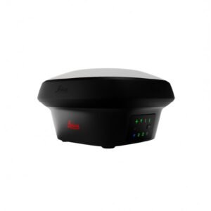
Imagine the power of GNSS positioning with imaging. A versatile survey-grade GNSS RTK rover with visual positioning.
The Leica GS18 I is a GNSS (Global Navigation Satellite System) receiver with built-in imaging from Leica Geosystems. It is a high-precision, high-performance surveying instrument providing rapid and accurate measurement of location, altitude, and orientation.
The integrated imaging allows users to take photographs of measurement points and associate them with GNSS data, improving the efficiency and accuracy of topographic surveys. Additionally, its robust and durable design makes it ideal for working in demanding outdoor conditions.
-
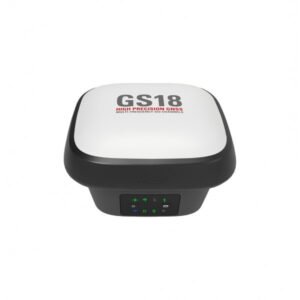
The original GNSS RTK rover with tilt compensation.
The GS18 T is a fast and easy-to-use GNSS RTK rover. The original GNSS solution with tilt compensation, immune to magnetic disturbances and requiring no calibration. Precise measurements on any terrain, even in complex urban environments. With its innovative technology, you will save time and improve your results.
-
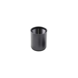
€27.00
Sunshade for digital spirit level.
-
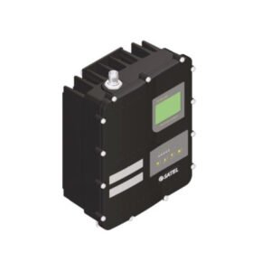
The Leica HPR4 is a new IP67-rated UHF radio modem that allows you to increase the RTK-UHF capabilities of your GNSS sensor.
The Leica HPR4 offers the best of the HPR2 and HPR3 capabilities. It supports wide modulation compatibility, channel spacing options, selectable power, and extensive country support.
-
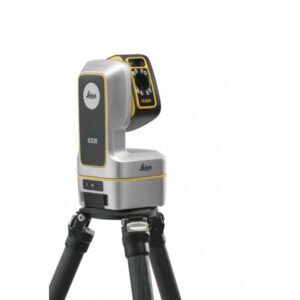
3D measurement and layout tool for professional applications.
The Leica iCON iCS20 is perfect for those looking to transition from traditional manual measurement methods to digital workflows. Its visual measurement technology provides an accurate representation of the current situation, avoiding omissions in the work process. Furthermore, the automated workflows and the Leica iCON trades software, specifically designed for the industry, significantly simplify the complexity of measurements.
-
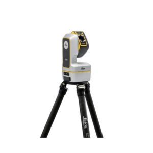
Robotic Leica iCON iCS50: The next-generation construction tool.
The perfect solution for both simple and complex 3D design and measurement tasks within the construction sector. This advanced construction tool is easy to operate, enabling rapid efficiency from its very first use.
By combining the Leica iCON iCS50 with intelligent accessories such as the Leica vPole and Leica vPen, the time required for design and measurement tasks is significantly reduced, while also minimising the risk of errors.
-
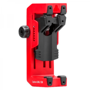
€84.00
The Leica Lino UAL 130 bracket is a high-quality laser levelling accessory that perfectly fits Leica Lino laser levels. With its adjustable head, the bracket allows precise and stable positioning of the laser level at any angle and height. It is easy to adjust and mount, and is compatible with 1/4″ and 5/8″ tripods. The Leica Lino UAL 130 bracket is the perfect solution for precise and hassle-free levelling and alignment work in construction and renovation.
-
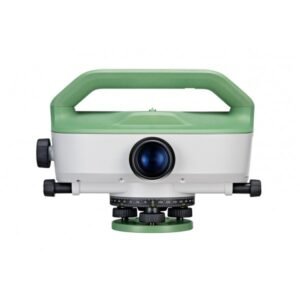
Leica Geosystems LS10 Optical Level. Maximum precision levelling. The Leica LS15 and Leica LS10 digital levels improve demanding levelling tasks anywhere. Their automatic functions and market-leading 0.2 mm accuracy allow users to easily demonstrate their measuring skills while effectively completing any project.
-
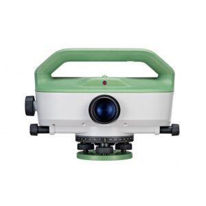
The Leica LS15 and Leica LS10 digital levels improve demanding levelling tasks anywhere. Their automatic functions and market-leading 0.2 mm accuracy allow users to easily demonstrate their measuring skills while effectively completing any project.
-
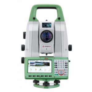
The ultimate all-rounder, combining total station functionality with 3D laser scanning, GNSS connectivity, and digital imaging.
Intelligent MultiStation with scanner for precision tasks. The Leica MS60 offers measurement accuracy of up to 0.5 mm at distances of up to 200 metres, making it one of the most precise tools on the market. Furthermore, its high-speed laser scanning system allows for the capture of 3D point clouds with exceptional image quality, facilitating the creation of detailed and accurate models of any terrain or structure.
The Leica MS60 also features a wide variety of integrated software tools that simplify the workflow and allow complex tasks to be performed with great ease. These include point cloud registration tools, model fitting, quality control, and much more.
-
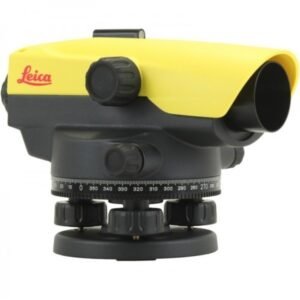
€415.00
The Leica NA524 is part of the new generation of automatic levels from Leica Geosystems, developed to offer greater precision, durability and ease of use in all types of surveying and construction work. This model replaces the renowned Leica Runner series, incorporating significant improvements in optics, ergonomics and reliability.
-
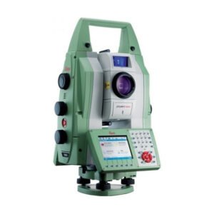
The most accurate and reliable monitoring total station with image management. The Leica TM50 total station is a high-tech tool used in surveying and construction. With its ability to perform precise and fast measurements, the TM50 is ideal for applications requiring a high level of accuracy and efficiency.
This total station offers a wide variety of advanced features, including a reflectorless measurement system, automatic tracking technology, wireless connectivity, and a high-resolution touchscreen. Furthermore, its robust and water-resistant design ensures it can be used in a wide range of environmental and terrain conditions.
With the TM50, users can perform angle and distance measurements with an accuracy of up to 0.5 arc seconds and 1 mm, making it one of the most precise total stations on the market. It also features the ability to perform height, coordinate, and orientation measurements, making it an essential tool for surveying, construction, and other related applications.
-
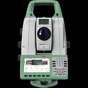
The first self-learning monitoring total station. The Leica TM60 total station is a next-generation surveying instrument designed to offer unprecedented precision and efficiency in the field of surveying and cartography. This tool is the perfect choice for professionals seeking the highest quality in measurements and map creation.
The Leica TM60 features an advanced reflectorless measurement system, allowing high-precision measurements at extremely long distances. Furthermore, its automatic pointing technology ensures accurate measurements even in low-visibility conditions.
Moreover, it boasts a wide range of functions and features that make its use extremely easy and efficient. Its high-resolution colour touchscreen allows for a clear and detailed visualisation of data and measurement results.
-
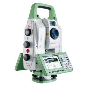
The world’s most accurate total station. The Leica TS60 total station is a cutting-edge instrument used in surveying and cartography that offers unsurpassed precision and efficiency in measuring distances, angles, and elevations.
A robust and resilient piece of equipment, designed to withstand the most demanding field conditions. With its wireless connectivity, it allows for quick and easy data transfer to other devices and surveying or mapping software.